Lo Savés, qu’es aquò* ?


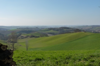
Left photograph: Scenic view of the Gers hillsides, taken from Plagnole. Credit M.Dubroca, 2011.
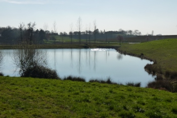
Right photograph: Lake of Lahage. Credit M.Dubroca, 2011.
This small region surrounding the town of Rieumes and located 40 km south of Toulouse is a Gascon territory encompassed by two rivers, the Save and the Garonne. Its western part is dominated by hillsides which then continue further into the Gers department. Numerous woods are also to be found here, remnants of the old Bouconne forest, criss-crossed with hiking trails. Rivulets flow into the many lakes that are used for irrigation purposes, offering a pleasantly green landscape in summertime. To the east, the high and the medium fluvial terraces of the river Garonne make up a plain which is covered with a network of rivers and streams such as the Aiguebelle, the Bure or the Touch. Savès is mainly a rural area that has been able to preserve perfectly bucolic landscapes to this day.


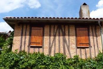
Left photograph: Half-timbered house. Credit M.Dubroca, 2011.
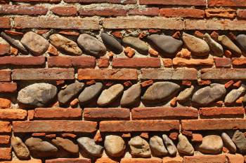
Right photograph: Traditional pebble and brick wall. Credit M.Dubroca, 2011.
Here, like everywhere else, local environment has influenced traditional architecture. The building materials have been gathered from the immediate surroundings: clay to make the regional bricks (known as “briques foraines”), and rounded stones to build the house façades and the walls most exposed to bad weather, both materials alternating into patterns so typical of the South-West of France. Some prestigious houses have kept their half-timber decoration to this day, and some still proudly display a dovecote. So, Savès is a great place to get “a good dose of fresh air ”!
* Savès, what is it? (in Occitan)


